By Miami Herald’s Alex Harris (TNS)
The most recent possible loss to federal weather research programs by the Trump administration puts hurricane forecasters at risk of losing a vital tool due to military concerns about the cybersecurity of a long-shared satellite system.
The Department of Defense said Monday that it is delaying the vital satellite imaging cutoff for at least a month in response to criticism and inquiries from numerous forecasting specialists.
According to James Franklin, a former head of the National Hurricane Center, forecasters would have a less accurate picture of storms overnight unless that deadline is extended or the military concerns are addressed. This could result in forecast delays of six hours or more, or even delayed watches and warnings to people in the path of storms.
Franklin, who retired from the National Hurricane Center in 2017, stated that there is no alternative to this imagery and that it will impact specific types of forecasts from the NHC. This is significant.
The department said Monday it was postponing the decommissioning until July 31—just before the August and September peaks of what is predicted to be another above-normal hurricane season—after a senior NASA official stepped in. That might just be a short-term relief.
The impending loss of the sophisticated microwave imaging is only the most recent in a string of changes to hurricane research that the Trump administration has declared. Other cuts include the elimination of uncrewed aircraft known as Saildrones, which gather data and widely shared video from the storm’s eye. The majority of the research carried out by the National Oceanic and Atmospheric Administration, including the Hurricane Research Division’s home laboratory, the Atlantic Oceanographic and Meteorological Laboratory in Miami, is to be discontinued, according to a comprehensive budget request made public on Monday.
The Department of Defense said last week that it will immediately cease sharing data from its Defense Meteorological Satellite Program, three weather satellites that collaborate with NOAA, because of a serious cybersecurity risk. This was the most recent contentious cut proposal.
Franklin and other meteorologists would want to see the service continued through at least the end of hurricane season, but he said he had no idea why the military would suddenly be concerned about a system that has been in use for decades.
Therefore, if you can prolong it for another month, how significant of a cybersecurity threat can it be? Can you prolong it during the height of hurricane season if you can extend it by one month? He inquired.
The missing satellite is a solitary dataset among a comprehensive suite of hurricane forecasting and modeling tools in the NWS portfolio, an agency representative told Michael Lowry of Local10, downplaying concerns. NOAA did not immediately respond to the Herald’s request for comment.
According to the agency, NOAA’s data sources are fully capable of offering a comprehensive suite of state-of-the-art data and models that guarantee the superior weather forecasting that the American people are entitled to.
Sunrise surprise
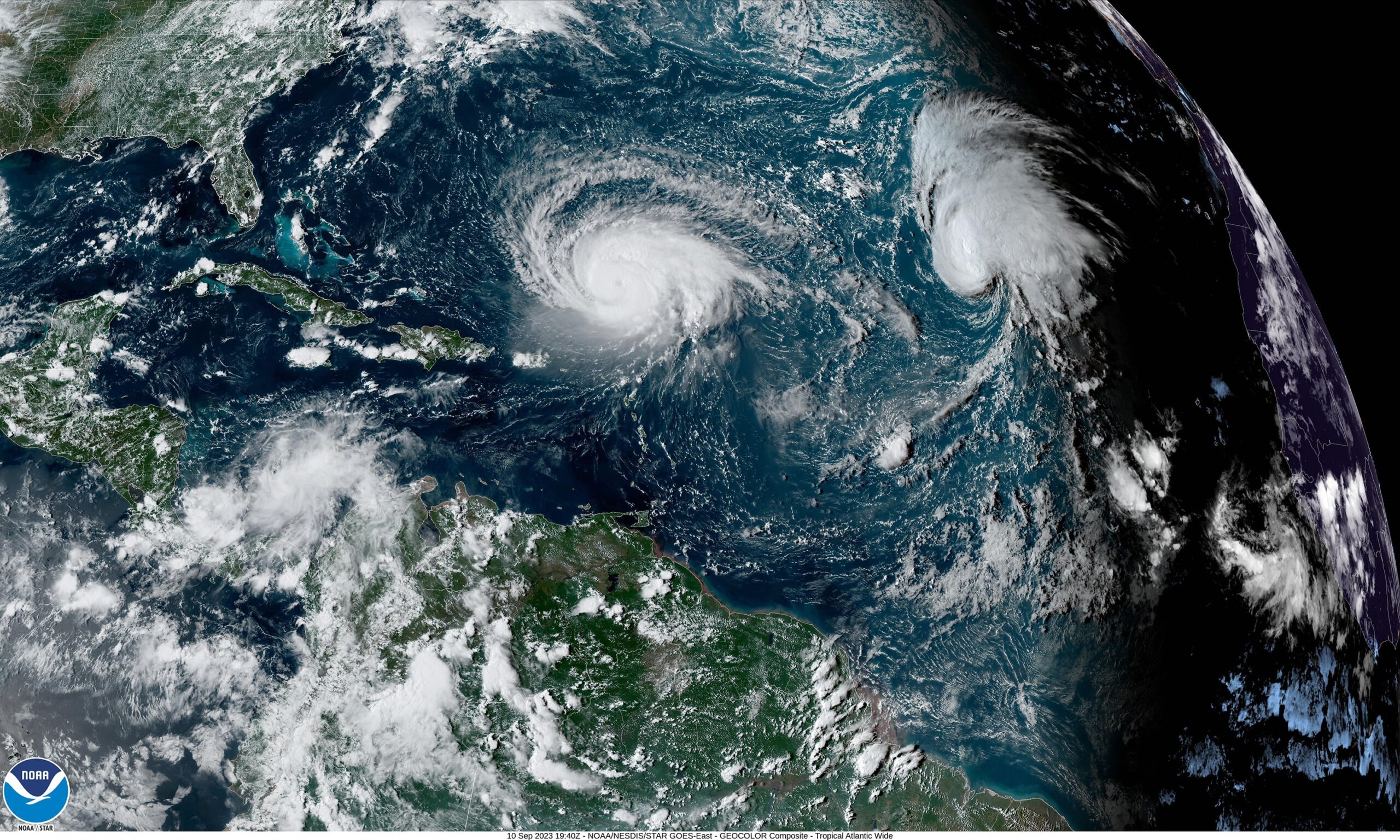
These satellites are irreplaceable, according to meteorologists. There is no other technology or data source that provides the same insight into the inner workings of a storm through the nighttime clouds.
On a gloomy and dark evening, forecasters can monitor significant changes to the rain bands encircling the storm core using the Special Sensor Microwave Imager Sounder, or SSMIS. According to Franklin, this provides forecasters with hints about whether a storm is likely to intensify rapidly, meaning it will get stronger and more intense very quickly.
He claimed that forecasts would receive a surprise sunrise either with or without that technology. They would awaken to a storm that was eight hours closer to reaching landfall and far more powerful or distinct than the one they had seen the night before.
When you lose it, it could take hours for a forecaster to find hints that a storm is about to go through this quick strengthening process from other kinds of data, he added, after these SSMIS data disappear. If you had received one of these microwave passes, you might have been aware of that six or ten hours earlier.
Forecasters can also keep an eye out for eyewall replacement cycles using the satellite data.
Frequently, a storm that is getting stronger will create a new eye that covers or surpasses the first one. A storm weakens and widens during that phase, causing its effects to be felt over a far larger area. When a storm passes through an eyewall cycle immediately before landfall, as was the case with Hurricane Katrina in 2005, it can significantly affect who is affected and how severely.
The satellite also allowed scientists flying into a storm know what they were up against and prepare for their task, according to former hurricane hunter Andy Hazelton.
One important component for looking under a storm’s hood is the microwave satellite. According to Hazelton, who is currently an associate scientist at the University of Miami, it lets us know what to anticipate.
Although hurricane hunter planes are the most effective means of observing changes such as this inside a cyclone, they are not deployed for every storm. According to Franklin, microwave passes are still the greatest choice for distant storms, lesser storms, or observing a storm in between plane flights.
Furthermore, losing that data could be crucial, particularly when attempting to map the core of distant evolving systems.
“I believe that in certain situations, these initial position estimates could be off by 50 or 60 miles or more without the microwave imagery,” he stated. The inaccuracies increase over time in proportion to your knowledge of the original state.
Few possible replacements
The Advanced Technology Microwave Sounder, or ATMS, is another satellite technology that NOAA included in their statement that provides forecasters with a glimpse of storms. The specifics of the military satellite being taken offline, however, are missing, according to hurricane experts.
“It’s like the visuals of a late 1980s video game compared to the 2010s,” Hazelton added. There is no resolution.
The satellites aren’t brand-new technology. The program’s first one was introduced in 1964, and it wasn’t until 1994 that NOAA took up shared responsibility for the technology. Franklin acknowledged that he is aware that at least one of the three will be phased out in September of the following year. However, there are no plans to replace him anytime soon.
Franklin stated that it is unclear whether forecasters will get access to the data from a new Department of Defense satellite with comparable capabilities that is scheduled to launch in October.
He claimed that it is somewhat odd to simply stop data processing while there is still usable life left. This wound is genuinely self-inflicted.
Hit after hit
Weeks after NOAA terminated its agreement with Saildrone, a commercial business that supplied many uncrewed drones that monitored hurricanes from the air and sea and relayed the data to scientists, the vital satellite was lost.
“Unfortunately, Saildrone is unable to support the Atlantic Hurricane mission this season due to the timelines associated with contracting, shipping, and transit,” the business stated in a statement. We have a long history of creative cooperation with NOAA, which carries over into numerous additional mission opportunities.
Hurricane researcher Hazelton stated that although Saildrone’s data was more experimental than the satellite’s, it nonetheless contributed to the development of better storm models.
He stated that the more data, the better. Losing these bits of information feels like one blow after another.
A more thorough budget request for the upcoming year was made public by NOAA on Monday for approval by Congress. It provides considerably more information on the potential cuts the agency would experience under the incoming presidential administration, even though it doesn’t deviate from the general budgetary framework that was made public earlier this year.
The budget calls for cutting all NOAA research at climate labs and cooperative institutes across the country, including the Miami-based AOML lab and its academic partnership with the University of Miami.
Hazelton calls this a massive blow to what has, for decades, been a bipartisan mission: improving hurricane forecasting.
Although it did not elaborate, the administration stated that important weather services would be restructured under the National Weather Service.
According to him, the proposal would essentially eliminate all NOAA research. Even if they were shifted to the National Weather Service on paper, this would affect almost all of our modeling, research, and development.
Miami Herald, 2025. www.miamiherald.com. Tribune Content Agency, LLC is the distributor.
Weather reports
-
Storm clean-up, power restoration continues in battered Carlisle neighborhoods
-
More than 10,000 without power after storms rip through central Pa.
-
More rain, damaging storms possible today in central Pa.
-
July 4 weekend forecast: What will the weather be like for fireworks?